5,200 Holes in a Peruvian Hillside, and the Answer Is Weirder Than Aliens
In 1933, an American aviator named Robert Shippee was flying survey runs over southern Peru when he looked down and saw something that shouldn't have been there.
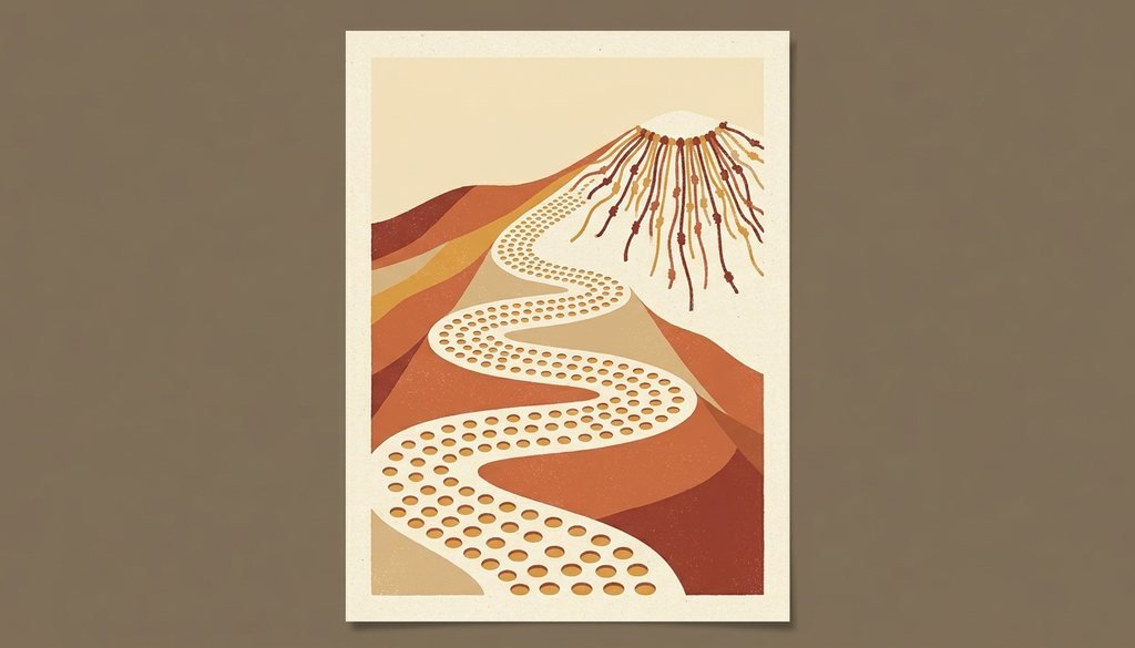
A band of holes. Thousands of them. Marching in tidy rows up a hillside for nearly a mile, over terrain steep enough to make you sweat on foot. From the air it looked like the mountain had a rash. One of its local names, Cerro Viruela, literally means "smallpox hill." The other name is Monte Sierpe: serpent mountain, for the way the whole thing snakes up the slope.
Shippee published his aerial photo in National Geographic, and for the next ninety-odd years, that photo did what unexplained aerial photos always do. It got weird.
The long parade of bad guesses
Here's the thing about Monte Sierpe: it's genuinely, structurally hard to figure out.
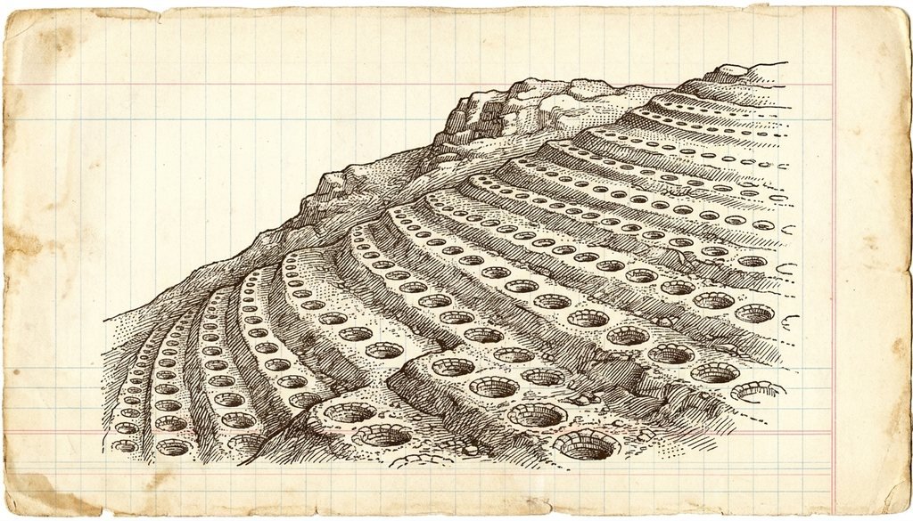
There are roughly 5,200 pits. Each one is about one to two meters across and up to a meter deep, lined with stone, with raised edges. They run in a band 14 to 22 meters wide for about 1.5 kilometers. And critically, almost nothing has ever been found in them. No pottery. No mummies. No tools. Archaeologists live on artifacts, and this site handed them essentially nothing to date or interpret.
So the theories piled up:
- Graves. Explorer Victor von Hagen surveyed the site in 1953 and concluded they were pre-Inca tombs. Empty ones. Thousands of stone-lined graves that nobody was ever buried in. As he cheerfully admitted, that made the mystery worse, not better.
- Defensive positions. Foxholes for an army that left no other trace.
- Water and fog capture. A clever bit of desert engineering to harvest moisture.
- Gardens. Thousands of tiny sunken planters.
- Storage. Archaeologist John Hyslop floated this one in 1984, noting the site sits suspiciously close to where two major Inca roads cross.
- Alien landing strips. You knew this was coming. Monte Sierpe made it onto Ancient Aliens and became a fixture of the pseudo-archaeology circuit, largely on the strength of "look at this photo, what else could it be?"
There's a reason the nonsense theories thrived here, and it isn't just that people love aliens. USF anthropologist Charles Stanish, who's studied Andean civilizations for over thirty years, put it plainly: the site is nearly impossible to read from the ground. "Even from the mountain above, you can't see its full pattern because of the permanent haze in the area." You can stand on Monte Sierpe and not see Monte Sierpe. All anyone had was one grainy photo from a biplane.
Then somebody flew a drone over it
In November 2025, an international team published a study in the journal Antiquity that finally moved the needle, and they did it with two unglamorous tools: a drone and a bag of dirt.
Lead author Jacob Bongers, a digital archaeologist at the University of Sydney, flew high-resolution low-altitude mapping runs over the whole 1.5 km stretch. Suddenly the pattern was legible for the first time in ninety years.
The holes aren't a continuous ribbon. They're organized into distinct blocks, separated by deliberate gaps that the team described as "crosswalks." The segmentation is mathematically structured. Somebody planned this.
And then the team noticed what the layout reminded them of.
The knotted-string spreadsheet
The Inca famously had no writing system. What they had instead was the khipu: bundles of knotted cords where the color, position, knot type, and grouping encoded information. Census figures. Tribute owed. Warehouse inventories. An empire of twelve million people, administered on string.
The segmented block structure the drone revealed at Monte Sierpe closely mirrors the organization of a khipu, including, specifically, one recovered from the very same Pisco Valley, now sitting in a museum in Berlin.
Which raises a genuinely delightful possibility: what if Monte Sierpe is a khipu you can walk on? Bongers floats exactly that question: "Was Monte Sierpe a sort of 'landscape khipu'?" A recordkeeping device rendered at the scale of a mountainside.
Then the dirt came back from the lab.
What was in the holes
Microbotanical analysis of sediment from the pits turned up two things.
Maize pollen. Corn, one of the most important staple crops in the Andes.
Reeds. Specifically, the kind traditionally used for millennia to weave baskets.
Put those together and you get something very specific: people were lining these holes with plant material and putting goods into them, carried there in woven baskets and bundles. Not graves. Not gardens. Not runways. Containers.
So what was it actually for?
Here's the picture the team assembled, and it's better than the alien version.
Monte Sierpe sits in a chaupiyunga, a transitional ecological zone between the high Andes and the coastal plain. It's parked between two Inca administrative centers, right near where a network of pre-Hispanic roads intersects. In other words: it's at the exact spot where highland people and coastal people would run into each other. Farmers and fisherfolk. Llama caravans coming down and seafaring merchants coming up. The regional population before the Spanish arrived was somewhere around 100,000.
The proposal is that Monte Sierpe started life under the pre-Inca Chincha Kingdom as a regulated barter marketplace: a standardized, permanent, physical grid where you brought your goods, dropped them in your assigned pit, and traded. Bongers compares it to a flea market, which is an almost aggressively humble description of a 5,200-unit stone monument.
Then the Inca showed up, absorbed the region, and did what states do to a marketplace. They turned it into an accounting system. The same grid of holes, now used to measure and tally tribute owed to the empire: a landscape-scale ledger, cross-referenced against the knotted strings back at the administrative center.
"Fundamentally," Bongers said, "I view these holes as a type of social technology that brought people together, and later became a large-scale accounting system under the Inca Empire."
Why this is the better story
Read that arc again, because it's the whole reason this site deserves your attention:
Ancient aliens → open-air farmers market → tax office.
Ninety years of speculation about visitors from other worlds, and the answer appears to be bureaucracy. Somebody's job, six hundred years ago, was to walk up a 50-degree slope in the haze and count corn.
There's a serious point tucked inside the joke, too. Stanish is blunt about what the pseudo-archaeology cost here: "One of the benefits of scientific work is the debunking of unsubstantiated claims that in many ways deprive Indigenous peoples of rightful ownership of their past." Every time Monte Sierpe got filed under "aliens," it stopped being an achievement of the Chincha and the Inca (sophisticated enough to build a standardized public marketplace and then scale it into a functioning tax apparatus, without writing) and became somebody else's mystery.
The parts still unsolved
This isn't a closed case, and the researchers are careful to say so. The evidence supports the marketplace-to-ledger interpretation; it doesn't nail it shut. Open questions include:
- Why here and nowhere else? If this was such a good idea, why is Monte Sierpe the only one? There's no second Band of Holes anywhere in the Andes.
- What else was in the pits? The team is now working on identifying more plant types found in the sediment, including some with possible medicinal properties. As Stanish put it: "With every identification of a new plant type, the Band of Holes becomes more intriguing."
- How exactly did the counting work? Nobody has decoded the specific correspondence between a block of holes and a khipu cord group. That's a translation problem waiting for someone to solve.
So the mystery isn't gone. It just grew up. It went from "what unearthly force made these" to "what precisely were the accounting conventions of a pre-Columbian Andean marketplace," which is a less cinematic question and a far more interesting one.
Ninety-three years after a pilot took one confusing photograph, a hillside in Peru turned out to be full of receipts.
Sources & further reading
- Bongers, J.L. et al., "Indigenous accounting and exchange at Monte Sierpe ('Band of Holes') in the Pisco Valley, Peru", Antiquity, November 2025 (open access)
- University of Sydney, "Mysterious holes in the Andes may have been an ancient marketplace"
- University of South Florida, "New study suggests accounting, not aliens, explains Peru's mysterious 'Band of Holes'"
- Stanish, C. & Tantaleán, H., "The Strange Site of Monte Sierpe in the Pisco Valley, Peru", Backdirt, 2015
- Band of Holes (Wikipedia)