Unusual Michigan Topography & Fun Facts Revealed
Did you know that Michigan is home to over 11,000 inland lakes, more than almost any other state? By most counts it ranks fourth, behind Alaska, Wisconsin and Minnesota. With such a vast number of bodies of water, it's no wonder that Michigan's topography is filled with unique and fascinating features. In this article, we will take a deep dive into the strange and intriguing landscapes of Michigan, uncovering fun facts and uncovering the geological wonders that make the Great Lakes State truly one-of-a-kind.
Key Takeaways:
- Michigan is home to over 11,000 lakes, making it a paradise for water enthusiasts.
- The state's topography is shaped by the Great Lakes, sinkholes, dunes, cliffs, and even volcanic remnants.
- Landmarks like Sleeping Bear Dunes, Pictured Rocks, and the Keweenaw Peninsula showcase Michigan's unique geology.
- Mysterious phenomena like disappearing ponds and giant collapse sinkholes add an element of intrigue to the state's terrain.
- Exploring Michigan's topography offers a captivating journey through nature's wonders.
The Great Lakes: Michigan's Water Wonderland
When it comes to unique Michigan landscapes and interesting geographical features, the Great Lakes take center stage. These majestic bodies of water not only define Michigan's borders but also sculpt its enchanting landscapes. Let's dive into the wonders of the Great Lakes and explore how they contribute to Michigan's distinctive topography.
Unleashing the Power of the Great Lakes
The Great Lakes, including Lake Superior, Lake Michigan, Lake Huron, Lake Erie, and Lake Ontario, are the largest group of freshwater lakes on Earth. These expansive bodies of water hold about 84% of North America's surface freshwater, providing a wealth of natural resources and recreational opportunities for Michiganders and visitors alike.
From the breathtaking shoreline vistas to the diverse ecosystems teeming with life, the Great Lakes create a harmonious blend of land and water that shapes Michigan's topography. The constant ebb and flow of waves have molded the coastal areas, forming stunning cliffs, dunes, and sandy beaches that stretch for miles.
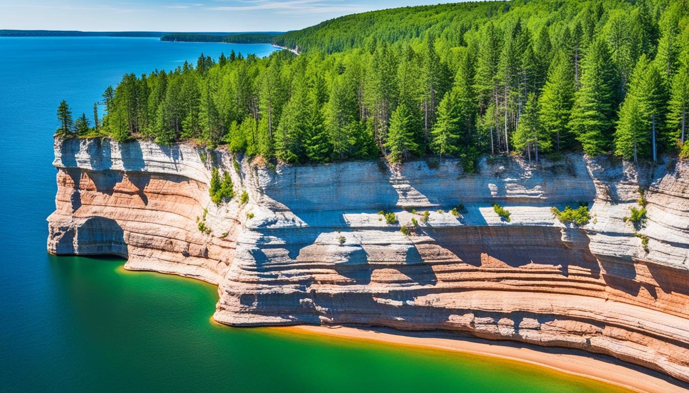
These natural formations create a unique backdrop for outdoor activities such as hiking, boating, and birdwatching. Visitors can explore the picturesque Pictured Rocks National Lakeshore, where dramatic sandstone cliffs rise from the turquoise waters of Lake Superior, or bask in the sun on the shores of Sleeping Bear Dunes National Lakeshore, home to towering dunes and panoramic views.
Unique Features and Biodiversity
Aside from their visual allure, the Great Lakes also harbor a diverse array of plants and animals. These vast bodies of water provide critical habitat for numerous species, including fish such as lake trout, salmon, and walleye, as well as migratory birds like the common loon and bald eagle.
The lakes' unique geographical features, such as the Manitou Islands in Lake Michigan and the Les Cheneaux Islands in Lake Huron, serve as protected sanctuaries for rare and endangered species. These natural havens offer nesting grounds for waterfowl, feeding areas for migratory birds, and sheltered habitats for various wildlife.
"The Great Lakes are not only a source of pride for Michigan but also serve as a testament to the extraordinary power of nature. They have shaped our land, influenced our climate, and provided endless recreational opportunities for generations."
Building a Sense of Community
The Great Lakes have not only shaped Michigan's physical landscape but also contributed to the state's cultural identity. Countless communities have sprung up along the shores, forming close-knit waterfront towns that rely on the lakes for their livelihood.
Fishing, shipping, and tourism industries thrive thanks to the abundant resources provided by the Great Lakes. From vibrant beachfront festivals to charming lighthouses that dot the coastline, the lakes play a vital role in connecting communities and fostering a strong sense of belonging.
| Lake | Surface Area (sq mi) | Maximum Depth (ft) | Average Depth (ft) |
|---|---|---|---|
| Superior | 31,700 | 1,333 | 483 |
| Michigan | 22,400 | 925 | 279 |
| Huron | 23,000 | 750 | 195 |
| Erie | 9,900 | 210 | 62 |
| Ontario | 7,340 | 802 | 283 |
As you can see from the table above, each Great Lake boasts impressive surface areas and depths, contributing to the vastness and allure of this captivating water wonderland.
Immerse yourself in the magic of the Great Lakes and be captivated by the beauty they bestow upon Michigan's unique landscapes. Their influence is felt in every corner of the state, reshaping the land and touching the lives of those who call Michigan home.
Taking a Dip into Sinkholes
Michigan is home to some intriguing geological wonders, including fascinating sinkholes. These bizarre land formations Michigan are not only visually striking but also hold clues to the state's geological history. Let's dive into the mysterious world of sinkholes and uncover their remarkable formation process, as well as their impact on Michigan's terrain oddities.
Sinkholes are natural depressions that form when soluble rock, such as limestone or gypsum, dissolves over time, causing the surface layer to collapse. As the ground sinks, it creates stunning sinkhole features that can vary in size and shape. The occurrence of sinkholes in Michigan can be attributed to the state's unique geology.
The heart of Michigan's sinkhole country is the karst region of Alpena and Presque Isle counties in the northeastern Lower Peninsula. Protected sites like the Stevens Twin Sinks Preserve near Alpena and the Mystery Valley Karst Preserve near Posen let researchers and visitors peer into the subterranean wonders of this curious geological phenomenon.
These sinkholes not only provide insights into Michigan's geological past but also serve as crucial habitats for various flora and fauna. The unique ecological conditions within sinkholes create microenvironments that support specialized plant and animal species. Exploring these sinkholes offers a glimpse into the interconnectedness of Michigan's ecosystems and the delicate balance that exists within them.
A deeper understanding of sinkholes is essential for both scientists and residents alike, as they can have significant implications for land use and development. Sinkholes have the potential to affect surrounding infrastructure, such as roads and buildings, making it crucial to consider their presence when planning and constructing in sinkhole-prone areas.
Michigan's sinkholes serve as reminders of the dynamic nature of our planet and the ever-changing landscape we inhabit. Exploring these natural wonders allows us to appreciate the beauty, complexity, and geological diversity that Michigan has to offer.
The Sleeping Bear Dunes: Michigan's Natural Treasure
When it comes to peculiar natural landmarks, the Sleeping Bear Dunes in Michigan take the spotlight. This awe-inspiring destination is not only a testament to the state's diverse topography but also holds historical and geological significance.
Stretching along the eastern coastline of Lake Michigan, the Sleeping Bear Dunes National Lakeshore showcases towering sand dunes, pristine beaches, lush forests, and breathtaking panoramic views. It's a paradise for nature enthusiasts and adventure seekers alike.
Intriguingly, the name "Sleeping Bear" is derived from an ancient Native American legend. According to the legend, a mother bear and her two cubs swam across Lake Michigan to escape a forest fire in Wisconsin. While the cubs successfully reached the shore, the mother bear, exhausted from the long swim, couldn't make it. The cubs waited for their mother in vain, eventually turning into two beautiful islands - North and South Manitou Islands.
The Geology of the Sleeping Bear Dunes
The formation of the Sleeping Bear Dunes is a fascinating geological story. Over thousands of years, wind, water, and ice have sculpted this unique landscape. The dunes were formed by the wind-blown sands from glacial outwash plains, deposited by receding glaciers during the last Ice Age.
Today, the Sleeping Bear Dunes comprise three primary types of dunes: perched dunes, beach dunes, and parabolic dunes. Each type contributes to the unique topography, showcasing the dynamic processes that have shaped the area over time.
The Sleeping Bear Dunes are a testament to the ever-changing forces of nature and serve as a reminder of Michigan's geological history.
Exploring the Sleeping Bear Dunes
Visitors to the Sleeping Bear Dunes can embark on a multitude of activities to experience the natural wonders firsthand. Whether it's hiking through the forested trails, climbing towering sand dunes, or relaxing by the pristine beaches, there's something for everyone.
The Pierce Stocking Scenic Drive is a popular way to explore the vast landscape. This 7.4-mile route takes visitors on a picturesque journey, offering breathtaking views of Lake Michigan, the dunes, and the surrounding forests.
For those seeking adventure, the famous Dune Climb lets you scramble up a mountain of sand and run (or tumble) back down — a Michigan rite of passage. (If you're craving a motorized dune buggy ride, that happens further south at Silver Lake Sand Dunes, Michigan's only ORV dune area — Sleeping Bear itself is kept wild.)
Interesting Facts about the Sleeping Bear Dunes
| Fact | Description |
|---|---|
| Size | The Sleeping Bear Dunes cover an area of approximately 71,187 acres. |
| Tallest Dune | The highest dune reaches an impressive height of 450 feet. |
| Recognition | The Sleeping Bear Dunes were designated as a National Lakeshore in 1970. |
| Activities | Visitors can enjoy hiking, swimming, camping, and scenic drives, among other activities. |
As you explore the Sleeping Bear Dunes, be sure to keep an eye out for the diverse wildlife that calls this area home. From white-tailed deer to foxes and numerous bird species, you never know what fascinating creatures you may encounter.
The Sleeping Bear Dunes are a true natural treasure, embodying the breathtaking beauty and unique topography that sets Michigan apart. Whether you're a history buff, a nature lover, or simply seeking an adventure, this iconic landmark is not to be missed.
The Pictured Rocks: Nature's Masterpiece
Journey along Lake Superior's shoreline and immerse yourself in the breathtaking beauty of the Pictured Rocks. This natural wonder is renowned for its unique geological features, vibrant colors, and rich historical significance. The Pictured Rocks stretch for 15 miles along Michigan's Upper Peninsula, offering visitors a captivating display of towering cliffs, mesmerizing rock formations, and fascinating caves.
One of the most iconic features of the Pictured Rocks is the vibrant colors that adorn the cliffs. The different hues, ranging from deep reds and oranges to striking blues and greens, are created by the minerals present in the rocks. Over millions of years, the forces of nature shaped these colorful cliffs, leaving behind a geological masterpiece that is sure to leave you in awe.
The rock formations at the Pictured Rocks are equally captivating. From the famous Chapel Rock, with its solitary tree perched on top, to the stunning Miner's Castle, eroded by wind and waves, each formation holds its own story and charm. Exploring the intricate patterns and textures of these geological marvels is like stepping into a natural art gallery.
The Pictured Rocks also have a rich historical significance. The Ojibwe (Anishinaabe) people revered this stretch of coast and considered it a place of power — their name for the area referred to the painted appearance of the rocks. That's also where the English name comes from: the cliffs are "pictured" not by human hands but by mineral stains — iron reds, copper greens, manganese browns — seeping down the sandstone face like paint.
The Pictured Rocks are a testament to the power and beauty of nature. As you hike, kayak, or take a boat tour along this magnificent stretch of Lake Superior, cherish the opportunity to witness this extraordinary geological masterpiece. It's a sight that will stay with you long after you leave.
Key Features of the Pictured Rocks:
- Vibrant, mineral-stained cliffs
- Fascinating rock formations
- Deep significance to the Ojibwe people
How to Explore the Pictured Rocks:
- Take a scenic boat tour for panoramic views of the cliffs and formations
- Hike along the Lakeshore Trail to get up close and personal with the rocks
- Kayak along the shoreline for a unique and immersive experience
| Time to Visit | Recommended Activities | Tips |
|---|---|---|
| Spring and Summer | Boat tours, hiking, kayaking | Book boat tours in advance, wear comfortable hiking shoes |
| Fall | Foliage viewing, photography | Check local weather conditions, capture the vibrant fall colors |
The Keweenaw Peninsula: A Volcanic Past
Discover the fascinating geological history of Michigan's Keweenaw Peninsula, where ancient volcanic activity has left its mark on the landscape. Situated at the northernmost tip of the Upper Peninsula, this region boasts unique features that showcase the state's curious geological formations.
The Keweenaw Peninsula was shaped by volcanic eruptions millions of years ago. Lava flows covered the land, leaving behind distinct remnants of this volcanic past. Today, visitors can explore the rugged coastline and witness breathtaking cliffs formed by these ancient lava flows.
One of the notable geological features in the Keweenaw Peninsula is the Quincy Mine. This historic copper mine offers a glimpse into the region's mining heritage and the impact of volcanic activity on the formation of valuable mineral deposits.
For nature enthusiasts, the Keweenaw Peninsula provides numerous opportunities to appreciate its unique beauty. From pristine forests to serene lakeshores, the peninsula offers a diverse range of landscapes that are a treat for the eyes.
Across the water, the same ancient lava flows built Isle Royale National Park, a secluded island paradise in Lake Superior (administratively part of Keweenaw County). This pristine wilderness showcases a variety of geological formations, including picturesque rocky shores and stunning inland lakes.
Notable Geological Features:
- Ancient lava flows
- Rugged coastline
- Quincy Mine
- Isle Royale National Park
Unearth the rich geological heritage of the Keweenaw Peninsula and immerse yourself in its unique landscapes. The volcanic past of this region has left behind remarkable features that continue to captivate visitors.
The Porcupine Mountains: A Wilderness Gem
Venture into the Porcupine Mountains and immerse yourself in nature's splendor. Discover the striking landforms, majestic waterfalls, and diverse ecosystems that make this area a true wilderness gem.
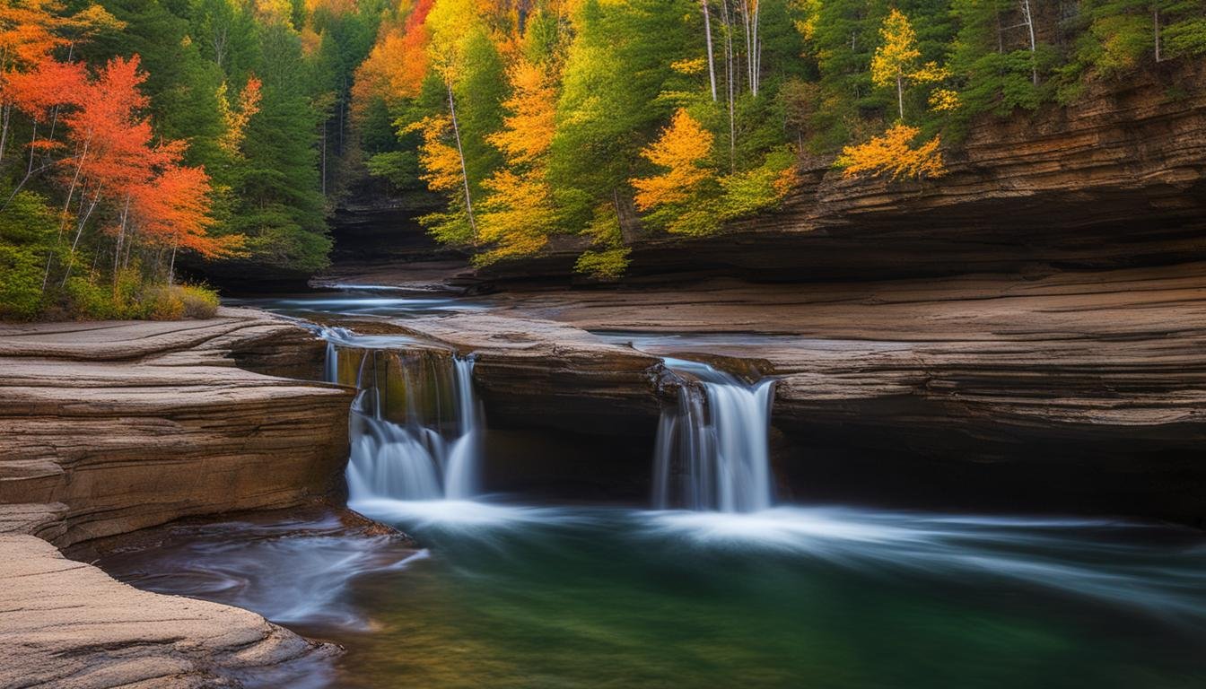
The Porcupine Mountains, also known as the "Porkies," are a hidden treasure nestled in the Upper Peninsula of Michigan. This pristine wilderness is home to a wide array of unique natural features that will captivate your senses and leave you in awe of Michigan's remarkable landscapes.
Awe-Inspiring Landforms
Explore an enchanting landscape shaped by ancient tectonic forces and glacial activity. The Porcupine Mountains are characterized by dramatic rock formations, steep cliffs, and breathtaking vistas that offer unparalleled panoramic views of Lake Superior. Witness the power of nature as you traverse rugged trails, ascend towering peaks, and immerse yourself in the timeless beauty of this untamed wilderness.
Majestic Waterfalls
Marvel at the splendor of the Porcupine Mountains' cascading waterfalls. These natural wonders create a symphony of sights and sounds as water plunges into pristine pools below. The Presque Isle River corner of the park is the showpiece: a chain of falls — Manabezho, Manido, and Nawadaha — thunders through a rocky gorge in the park's western reaches. (Bond Falls, one of Michigan's largest waterfalls, makes a worthy detour about a half hour southeast of the park.) Each waterfall in the Porcupine Mountains is a testament to the region's unique geological history and offers a tranquil oasis for relaxation and reflection.
Diverse Ecosystems
Embark on an exploration of the Porcupine Mountains' rich biodiversity. This wilderness sanctuary is home to old-growth forests, including stands of towering hemlock and pine trees that have stood for centuries. Wildlife enthusiasts will be thrilled by the chance to spot rare species such as moose, wolves, and bald eagles in their natural habitat. Immerse yourself in the sights, sounds, and scents of nature as you hike through lush meadows, tranquil wetlands, and pristine rivers.
Whether you're an avid hiker, a nature lover, or simply seeking tranquility in a breathtaking setting, the Porcupine Mountains offer an unforgettable experience. This unique natural gem showcases Michigan's diverse landscapes and leaves visitors with a deep appreciation for the wonders of the Great Lakes State.
The Thumb: A Quirky Appendage
Michigan's unique topography is full of surprises, and one of its most intriguing features is the geographical oddity known as "The Thumb." Located in the southeastern part of the state, this appendage-shaped region juts out into Lake Huron, forming a distinct shape that sets it apart from the rest of Michigan's landmass.
The Thumb is characterized by a gently rolling landscape, dotted with picturesque farmland, charming small towns, and stunning waterfront views. Its distinctive shape is a result of glacial activity during the last Ice Age, which carved out the Great Lakes and shaped the land we see today.
How did The Thumb come to be? The receding glaciers left behind depressed areas and melting ice, creating large bodies of water that eventually became the Great Lakes. The glaciers also left behind moraines and other glacial features, which contributed to the formation of The Thumb's unique shape.
Despite its smaller size compared to other regions in Michigan, The Thumb boasts a rich agricultural heritage. Its fertile soil and favorable climate make it an ideal region for farming, particularly for crops like sugar beets, corn, soybeans, and dry beans — the Thumb is one of America's navy bean capitals. The Thumb's agricultural contributions are a significant part of Michigan's economy and culinary traditions.
In addition to its farming prowess, The Thumb offers residents and visitors alike a wide range of outdoor activities. From boating and fishing on Lake Huron to exploring the charming coastal towns and lighthouses, there is no shortage of things to see and do in this quirky appendage of Michigan.
So, if you're up for an adventure and want to experience something truly unique, make sure to include a visit to The Thumb in your Michigan itinerary. You'll be captivated by its distinctive shape, picturesque landscapes, and welcoming communities.
The Ice Caves: Chilling Yet Spectacular
Prepare to be mesmerized by the enchanting beauty of Michigan's ice caves. These natural wonders are created during the winter months, showcasing an extraordinary fusion of ice and rock formations. Discover the intriguing process behind their formation and marvel at their unique and stunning landscapes.
Michigan's ice caves are peculiar natural landmarks that captivate visitors with their breathtaking charm. As temperatures drop, water seeps into rock crevices and freezes, forming intricate ice formations that transform these caves into ethereal winter landscapes. The result is a magical display of shimmering ice stalactites, stalagmites, and ice crystals that adorn the cave walls and ceilings.
Exploring the ice caves is a truly unique experience. Visitors can walk through passages lined with glistening ice formations, marvel at the sparkling icicles hanging from the ceilings, and witness the interplay of light and ice that creates a surreal atmosphere. The caves offer a winter wonderland adventure that showcases the incredible beauty and power of nature.
Michigan's ice caves are not only visually stunning but also of geological importance. They provide scientists with valuable insights into the dynamic processes occurring within the state's unique landscapes. Studying these caves helps uncover the intricate relationship between water, geology, and climate, contributing to our understanding of Michigan's natural history.
Exploring Michigan's Ice Caves: Tips and Precautions
If you're planning to visit Michigan's ice caves, here are a few tips to ensure a safe and enjoyable experience:
- Dress warmly and wear appropriate footwear to navigate icy and snowy terrain.
- Check weather conditions and ice stability before visiting. It's essential to prioritize safety.
- Follow designated trails and respect any access restrictions to preserve the delicate natural environment.
- Bring a camera to capture the incredible beauty of the ice caves, but remember to be present and appreciate the experience firsthand.
The Spectacular Beauty of Michigan's Ice Caves
Michigan's ice caves are truly nature's masterpiece. The intricate ice formations and the serene atmosphere transport you to a different world — a breathtaking sight worth experiencing at least once.
A Comparison of Michigan's Unique Landmarks
| Landmark | Description |
|---|---|
| The Sleeping Bear Dunes | A stunning sand dune formation stretching along Lake Michigan's shoreline. It offers panoramic views and diverse outdoor activities. |
| The Pictured Rocks | A breathtaking stretch of colorful sandstone cliffs along Lake Superior, adorned with unique rock formations and picturesque waterfalls. |
| The Keweenaw Peninsula | A volcanic region showcasing remnants of ancient lava flows, rugged coastlines, and stunning views of Lake Superior. |
| The Porcupine Mountains | A wilderness gem with stunning mountain peaks, majestic waterfalls, and diverse ecosystems, perfect for hiking and outdoor exploration. |
The Mackinac Island Geological Marvels
Step back in time on Mackinac Island and witness its fascinating geological features. This beloved destination is not only known for its charming historic sites and horse-drawn carriages, but also for the unique rock formations that dot its landscape.
One of the most intriguing geological features on Mackinac Island is Arch Rock. This iconic limestone formation stands 146 feet above the shoreline and provides visitors with stunning views of Lake Huron. The arch was formed by thousands of years of erosion caused by wind, water, and ice, resulting in a natural marvel that continues to awe and inspire.
Another remarkable rock formation on Mackinac Island is Sugar Loaf. This towering limestone stack rises 75 feet above the ground and serves as a testament to the island's geological history. Originally, Sugar Loaf was connected to the island's shoreline, but over time, erosion and weathering caused it to become detached.
Aside from these impressive rock formations, Mackinac Island is also home to geological treasures such as limestone caves and glacial potholes. These unique features offer visitors a glimpse into the island's rich geological past and highlight the fascinating processes that shape Michigan's topography.
| Geological Marvel | Description |
|---|---|
| Arch Rock | A natural limestone arch formation standing 146 feet above the shoreline, offering stunning views of Lake Huron. |
| Sugar Loaf | A towering limestone stack that reaches a height of 75 feet, showcasing the island's fascinating geological history. |
| Limestone Caves | Explore the mysterious limestone caves and discover the underground wonders of Mackinac Island. |
| Glacial Potholes | Marvel at the unique glacial potholes created by ancient ice formations, providing a glimpse into the island's geological past. |
Michigan's Precious Ponds: Paradoxes of Nature
Step into the enchanting world of Michigan's ponds, where nature never fails to surprise us with its paradoxical creations. These small bodies of water, scattered throughout the state, hold curious geological formations that add an extra layer of wonder to Michigan's topography.
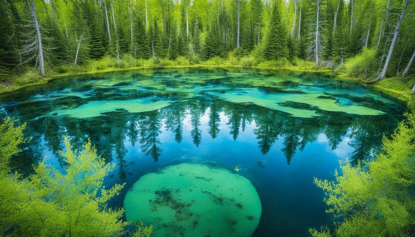
One captivating phenomenon found in Michigan's ponds is the disappearing pond. These ephemeral pools seem to vanish before our eyes, appearing and disappearing with the changing seasons. The mystery lies in their unique hydrological characteristics, where the water table rises and falls, giving rise to these temporary marvels.
Another fascinating feature found within Michigan's ponds is the underwater forest. Imagine, beneath the shimmering surface, lies a hidden world of submerged trees, their ghostly forms swaying gently with the currents. These submerged forests are remnants of ancient forests that date back thousands of years when the water levels were lower, and the land was different.
Michigan's ponds hold secrets beneath their calm surface. Disappearing ponds and underwater forests offer glimpses into the dynamic nature of the state's unique topography.
Exploring these paradoxes of nature allows us to appreciate the ever-changing and evolving landscape of Michigan. It reminds us that even in seemingly static environments, natural processes continue to shape and transform our surroundings.
Curious Geological Formations in Michigan's Ponds
To further understand the peculiarities of Michigan's ponds, let's take a closer look at the curious geological formations that can be found beneath the water's serene facade:
| Formation Type | Description |
|---|---|
| Sinkholes | A result of underground erosion, sinkholes create depressions that can fill with water, forming small ponds. These sinkholes can range in size and depth, and their presence adds an intriguing dimension to Michigan's pond diversity. |
| Kettle Ponds | Formed by the retreat of glaciers, kettle ponds are depressions left behind by blocks of ice that were buried and later melted. These round or oval-shaped ponds can provide a habitat for unique flora and fauna. |
| Marl Pits | Marl pits are the result of excavation for marl, a type of sediment rich in calcium carbonate. Once the marl is extracted, the pits can fill with water, turning into small ponds. These ponds often have a milky appearance due to the suspended particles of calcium carbonate. |
| Vernal Pools | These shallow woodland pools fill with snowmelt and spring rain, burst with life — fairy shrimp, chorus frogs, salamanders — and then vanish entirely by summer, earning them the nickname "disappearing ponds." |
Michigan's ponds are a testament to the beauty and diversity of our state's topography. They showcase the delicate balance of land and water, and the ever-changing natural forces that continue to shape the landscape. Take a moment to appreciate the paradoxes and wonders found within these serene bodies of water, as they offer a glimpse into the complex and fascinating geological history of Michigan.
Isle Royale: A Geological Gem in Lake Superior
Embark on an adventure to Isle Royale, a remote island nestled in the breathtaking beauty of Lake Superior. This hidden gem boasts a myriad of captivating geological features, making it a must-visit destination for nature enthusiasts and geology aficionados alike.
Dating back over a billion years, Isle Royale showcases ancient rock formations that have withstood the test of time. These rugged landscapes tell a fascinating story of the Earth's geological evolution, providing a glimpse into the dynamic forces that shaped Michigan's topography.
As you explore Isle Royale's trails and coastline, be prepared to encounter a diverse range of flora and fauna. The island's unique ecosystem supports a variety of plant species, including rare orchids and towering old-growth forests.
"Isle Royale is an ecological treasure trove, offering visitors a chance to witness the harmonious interplay between geology and biodiversity. It's a place where the wonders of the natural world converge."
Designated as a national park in 1940, Isle Royale safeguards its remarkable geological and ecological heritage. Its protected status allows for the preservation of this remarkable outdoor classroom, offering visitors an opportunity to deepen their understanding of Michigan's natural wonders.
To truly appreciate the awe-inspiring beauty of Isle Royale, take in the panoramic views of Lake Superior from the island's stunning cliffs and rocky shores. Witness the power of the crashing waves and the tranquil serenity of the vast expanse of water, all while surrounded by the island's unique terrain.
Isle Royale: Quick Facts
- Location: Lake Superior
- Size: 206.73 square miles
- Established: 1940 (National Park)
- Designated UNESCO Biosphere Reserve
- Approximate Visitor Count (2019): 26,410
Whether you're a geology enthusiast, outdoor adventurer, or simply seeking a tranquil retreat in nature, Isle Royale promises an unforgettable experience. Immerse yourself in its geological wonders, breathe in the crisp fresh air, and let the magical landscapes of this remote island captivate your senses.
The Michigan Basin: A Geological Marvel Below the Surface
While Michigan's unique landscapes above ground are splendid, there is an equally fascinating world beneath the surface. Deep below Michigan's topography lies the hidden wonder of the Michigan Basin, a geological marvel that has captivated scientists for decades.
The Michigan Basin is a vast subsurface feature spanning tens of thousands of square miles — it underlies essentially the entire Lower Peninsula and reaches beyond the state's borders. This deep basin is defined by its intriguing geological formations and complex layers that have shaped Michigan's landscape over millions of years.
Uncovering the Layers of the Michigan Basin
When we delve into the depths of the Michigan Basin, we unearth a rich tapestry of geological history. The basin consists of layers upon layers of sedimentary rocks, each representing a different era and offering valuable insights into the state's geological past.
At the base of the Michigan Basin lies the Precambrian rock, dating back over a billion years. This ancient layer provides evidence of Michigan's early geological evolution and is the foundation upon which subsequent layers were deposited.
As we ascend through the layers, we encounter the Michigan Group, consisting of various rock formations deposited during the Paleozoic Era. These formations include limestone, dolomite, and shale, which were created by ancient seas that once covered the Michigan Basin.
Above the Michigan Group, we find the rich deposits of evaporites, such as salt and gypsum, left behind by the evaporation of seawater. These formations, known as the Salina Formation, provide valuable resources and play a significant role in Michigan's economy.
The layers of the Michigan Basin continue to reveal a fascinating story of the state's geological past. From the coal-rich deposits of the Pennsylvanian Period to the glacial remnants of the Pleistocene Epoch, each layer contributes to Michigan's diverse and unique topography.
Geological Significance and Exploration
The Michigan Basin's geological importance extends beyond its captivating layers. It is home to significant natural resources, including oil, gas, and minerals, which have contributed to the state's economic growth and development.
The exploration of the Michigan Basin has been a subject of great interest for scientists and geologists. Through drilling and careful study of the layers, researchers gain valuable insights into the state's geological history, as well as the potential for further resource discovery.
Understanding the complex layers and geological processes within the Michigan Basin is crucial for various industries, such as oil and gas extraction, mining, and environmental research. It allows for informed decision-making and sustainability practices that protect both Michigan's natural treasures and its thriving communities.
Appreciating Michigan's Hidden Wonders
The Michigan Basin may be hidden beneath our feet, but its impact on the state's topography is undeniable. By exploring this geological marvel, we gain a deeper appreciation for the diverse landscapes and unique features that make Michigan truly exceptional.
As we continue our journey through Michigan's remarkable topography, let us not forget to pause and acknowledge the hidden wonders that lie beneath the surface. The Michigan Basin serves as a reminder of the dynamic forces that have shaped and continue to shape our planet's landscapes.
| Layers of the Michigan Basin | Geological Era/Epoch |
|---|---|
| Precambrian rock | Over a billion years old |
| Michigan Group | Paleozoic Era |
| Salina Formation | Paleozoic Era |
| Coal deposits | Pennsylvanian Period |
| Glacial remnants | Pleistocene Epoch |
The Sinkholes Pathway: Michigan's Doorways to the Underworld
Prepare to uncover one of Michigan's most intriguing and least-known natural wonders — the giant collapse sinkholes of Presque Isle County. Near the small town of Onaway, the Sinkholes Pathway in the Mackinaw State Forest skirts the rims of five enormous, forest-lined craters that plunge as much as a hundred feet or more into the earth. Standing at the railed overlook, it's easy to see why early visitors spoke of them in almost supernatural terms.
These chasms are extraordinary examples of Michigan terrain oddities. Their formation process is as captivating as the sinkholes themselves: over thousands of years, groundwater slowly dissolved the limestone bedrock far below, hollowing out caverns. Eventually the weight of the land above became too much for the weakened rock, and the surface collapsed — leaving these mesmerizing craters behind.
The same karst plumbing produces some genuinely eerie neighbors. Nearby Shoepac Lake fills a flooded sinkhole, and Sunken Lake occupies another collapse. Most dramatic of all is Rainy Lake's region of "disappearing" waters, where lake levels have been known to drop suddenly as water drains into the karst below — as if someone, somewhere, pulled a plug.
Walking the Rim
The Sinkholes Pathway offers a short rim loop and a longer hike, with a wooden stairway descending into the largest crater. Standing on the floor of a sinkhole, surrounded by walls of layered limestone and cedar, you get a rare worm's-eye view of Michigan's geological underworld — the intricate patterns of rock telling a tale of ancient seas, dissolved stone, and sudden collapse.
Michigan's sinkhole country is a testament to the hidden forces beneath our feet — proof that even a state famous for its water holds surprises underground.
Whether you're a nature enthusiast, an avid explorer, or simply curious about the wonders of our planet, Michigan's sinkhole country promises an experience unlike anywhere else in the state.
Conclusion
After journeying through the fascinating topography of Michigan and uncovering its many quirks and wonders, it is clear that this state is truly a treasure trove of unique geological features. From the majestic Great Lakes to the mesmerizing Sleeping Bear Dunes, Michigan's landscapes continue to captivate and inspire.
Immerse yourself in the awe-inspiring beauty of Pictured Rocks or explore the volcanic origins of the Keweenaw Peninsula. Take a dip into the mysterious sinkholes or marvel at the wilderness gem that is the Porcupine Mountains. Michigan offers a plethora of natural marvels that will leave you spellbound.
So, pack your bags and embark on a journey to Michigan, where you can embrace the incredible diversity that shapes the Great Lakes State. Discover the wonders of this unique topography and create memories that will last a lifetime.
FAQ
What are some fun facts about Michigan's topography?
Michigan is composed of two peninsulas: the Lower Peninsula and the Upper Peninsula. The state is also surrounded by four of the five Great Lakes, making it the only state to touch so many of these freshwater giants. The state's highest point is Mount Arvon in the Upper Peninsula, reaching a height of 1,979 feet (603 meters) above sea level. Additionally, Michigan boasts over 11,000 inland lakes, more than many other states in the United States.
What unique geographical features can be found in Michigan?
Michigan is known for its impressive sand dunes, particularly the Sleeping Bear Dunes along Lake Michigan. These towering dunes provide breathtaking views of the surrounding landscape. The state is also home to the Pictured Rocks National Lakeshore, where striking cliffs and vibrant rock formations can be seen along Lake Superior's shoreline. Additionally, the Keweenaw Peninsula showcases remnants of its volcanic past, with rugged coastlines and ancient lava flows.
Are there any bizarre land formations in Michigan?
Yes, Michigan is home to several sinkholes, which are unique geological formations resulting from the collapse of dissolved limestone bedrock. The most spectacular are along the Sinkholes Pathway near Onaway in Presque Isle County, where five giant forested craters — some more than a hundred feet deep — line a short hiking trail, with sinkhole lakes like Shoepac Lake and Sunken Lake nearby.
What makes the Sleeping Bear Dunes a natural treasure?
The Sleeping Bear Dunes, located along Lake Michigan, are a stunning natural marvel. This area features towering sand dunes that can reach heights of up to 450 feet (138 meters) above the lake. The dunes offer panoramic views of Lake Michigan and the surrounding forests, making it a popular destination for hiking, sandboarding, and photography.
What can be seen at the Pictured Rocks?
The Pictured Rocks National Lakeshore is renowned for its colorful cliffs and fascinating rock formations. Visitors can witness the stunning interplay of colors created by mineral stains on the cliffs. Additionally, the area is home to several notable landmarks, including the iconic Chapel Rock and Miners Castle, which provides an observation deck with breathtaking views of Lake Superior.